Canopy cover — the proportion of ground area shaded by tree crowns when viewed from above — is a standard metric in urban forestry. Canadian cities have begun measuring it systematically using LiDAR surveys and satellite imagery, producing data that municipal planners use to set targets and track progress.
The relationship between tree canopy and urban conditions is well-documented in research literature, though the magnitude of effects varies considerably by city, neighbourhood type and measurement method.
Surface Temperature
Trees reduce surface and air temperatures through two mechanisms: shading reduces direct solar radiation reaching pavement and buildings, while transpiration releases water vapour that cools surrounding air. The combined effect on surface temperature under tree canopy is measurable in studies using thermal imaging and ground sensors.
Research published through the Natural Resources Canada urban forestry program and peer-reviewed journals consistently documents lower surface temperatures under canopy compared to adjacent unshaded pavement. The magnitude varies with tree size, canopy density, surrounding paving materials and local climate, making exact comparisons between cities difficult.
Canadian urban heat island research, including work conducted in Toronto, Vancouver and Montreal, shows that treed neighbourhoods record measurably lower air temperatures during summer heat events than comparable neighbourhoods with sparse canopy. The relationship is strongest during afternoon peaks and weakens overnight as all surfaces radiate stored heat.
The Natural Resources Canada urban forests page provides an overview of federal research on urban tree benefits, including links to published studies on heat, carbon and stormwater effects.
Air Quality
Trees remove particulate matter, nitrogen dioxide and ozone from the air through deposition on leaf surfaces and stomatal uptake. The quantity removed depends on leaf area, species, season and local pollution concentrations.
Urban forestry researchers caution that trees alone are not a substitute for source reduction of air pollutants. The removal rates documented in published studies, while real, are relatively small compared to total urban pollution loads. Trees are more valuable in air quality terms for their microclimate effects — reducing building energy demand lowers fossil fuel combustion — than for direct pollutant capture.
Certain conifer species can also emit volatile organic compounds (VOCs) that, in high concentrations combined with nitrogen oxides from traffic, contribute to ozone formation. Species selection in high-traffic urban corridors accounts for this where data on local pollution chemistry is available.
Stormwater Management
Tree canopy intercepts rainfall before it reaches impervious surfaces. Intercepted water either evaporates from leaf surfaces or runs down the trunk and enters soil at the tree base, where it infiltrates rather than running off. Trees with extensive root systems also increase soil permeability, improving infiltration across a wider area than the canopy footprint alone.
Municipal engineers increasingly incorporate trees into green infrastructure calculations for stormwater management. Cities including Toronto and Vancouver reference tree canopy in their stormwater management plans, assigning trees a measurable role in reducing combined sewer overflow volumes during heavy rainfall events.
Canadian Municipal Canopy Targets
Several Canadian cities have adopted formal canopy cover targets. The figures vary and reflect local baselines, available land and municipal priorities:
- Toronto: A target of 40% canopy cover, up from a baseline of approximately 27%, outlined in the city's urban forestry strategy
- Vancouver: Canopy cover goals integrated into the Greenest City Action Plan, with periodic LiDAR-based assessments tracking progress
- Edmonton: Canopy targets embedded in the Urban Forest Management Plan, with attention to northern hardiness zone constraints
Targets are expressed as citywide averages, but canopy distribution is typically uneven. Lower-income neighbourhoods in several Canadian cities have documented lower canopy cover than wealthier areas, a pattern that urban forestry advocates and researchers have noted as a distributional equity issue in green infrastructure access.
Measuring Canopy Cover
LiDAR (Light Detection and Ranging) surveys carried out from aircraft or drones produce three-dimensional point clouds that distinguish tree canopy from buildings and other surfaces. Combined with high-resolution aerial photography, these data sets allow municipalities to calculate canopy cover percentages at the neighbourhood or individual parcel level.
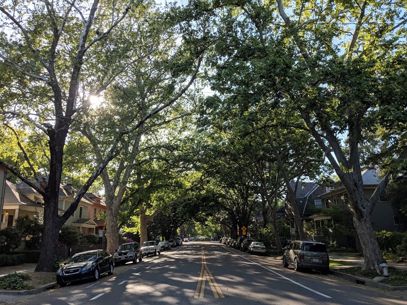
The City of Toronto's urban forestry team has conducted multiple citywide canopy assessments, with results published and accessible through the city's open data portal. These assessments show canopy cover varies from below 10% in some industrial and commercial zones to above 50% in established residential neighbourhoods with mature street and yard trees.
Carbon Storage
Urban trees store carbon in woody biomass and contribute to reduced building energy use, which lowers greenhouse gas emissions from heating and cooling. The carbon storage values attributed to individual trees in urban settings are documented in the i-Tree suite of tools developed by the USDA Forest Service, which several Canadian cities use to calculate ecosystem service values for their urban forest inventories.
Tree Canada's national programs reference carbon benefits in their public materials, though urban trees contribute relatively small quantities of carbon storage compared to managed forests. Their climate value in cities is considered primarily through energy use reduction rather than direct sequestration.
Last updated: May 2026. Data cited reflects publicly available research and municipal reports; specific figures vary by study methodology and local conditions.